Still not sold on the snow, BUT let's look at the snowiest data I can find in order to wishcast it to Region 8! This is the 6Z (Midnight) run of the GFS model for Monday Night:
The blue line is typically a good starting point for the coveted "rain/snow" line. LOOK, we're north of it!!! *wishcast, wishcast, wishcast*
The green is precipitation and it shows some on Region 8! *wishcast, wishcast, wishcast*
Next image is the data in graphical form...
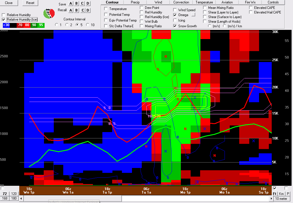
This is BUFKIT and the blue lines indicate snow on this model run for Monday evening. *wishcast, wishcast, wishcast* The purple/yellow lines are the best places for snow to form. The yellow area is the "best" environment for snow dendrites to form. *wishcast, wishcast, wishcast*
IF this happened, we could see 1-2" of snow in parts of Region 8 and more in SOUTH of us in Central Arkansas. Look again... that's a big "if".
Let's did a little deeper...
I added a few more things to the graph. I added RH (Relative Humidity) in the red and green to show that we will have moisture. I also added surface temperature with the red line, which shows we'll be cold enough. *wishcast, wishcast, wishcast* I also added "Omega" which is the rising motion of the air. It's not that impressive, which leads me to think that this is NOT going to be a big storm. Let me clarify... If we see 1" or less, I consider that to be minor. Sorry, snow lovers.
Once again, this is me searching for the "snowiest" data I can find. Most data suggest dry, but still cold. We'll have a slight chance in the forecast regardless until we get closer to next week. *wishcast, wishcast, wishcast*
In fact... the latest GFS data coming in shows even less moisture. Flurries.... Keep Wishcasting everyone! LOL
Ryan


1 comment:
Dang Ryan that is just plain wrong..lol That's OK before this winter is over your fancy panic-o-meter will go off. It isn't even winter yet so we will let this one slide.
Post a Comment