- Wind on Thursday and Friday should blow at 15-20 mph. The best chance for 20 mph wind is Thursday night. This should be NOTHING like Ike from a few years ago.
- Rainfall amounts are still questionable because it all depends on the TRACK. The east side of the track would be the wettest, so the eastward trend in the track is favorable.
- There will be a SHARP cutoff on rain totals. Some parts of a county will see less than an inch, while another part of the county may see 4-5".
- Whoever is near the center or east of center, could get 6"+ of rainfall.
- Tornadoes are possible near the center and east of center. These would be small, but fast developing tornadoes.
- Thursday night Jr. High games may be soggy and breezy.
- The heaviest rain will hopefully be gone by Football Friday Night.
- The weekend should be mostly dry.
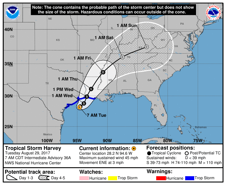
Let's dig into some maps! First , let's look at the official forecast track from the National Hurricane Center:
The NHC is leaning towards this more eastern solution because of a couple of models that have been handling the weather nicely lately: The European and NAM. For those of us not wanting, heavy rain... we want this solution to pan out. It's faster and more east. Let me explain...
The European has the center of Harvey nearby on Friday MORNING and in Northern Mississippi and Tennessee:

The NAM has a VERY similar solution:

Here are the rainfall projections from both of those models. Notice, the Euro still has the extreme eastern parts of Region 8 getting A LOT of rain:
Euro:

NAM:

Now, let's talk about the worst case scenario. The GFS has not been doing as well and typically is not the most accurate model, but it occasionally beats it's competition. I hope that is not the case with this storm. It has a SLOWER and more WEST track. In fact, it still has Harvey on top of us on Friday evening:

Because it has the track of Harvey going right over us, the rainfall projections are crazy high:

Yes, that shows a larger area getting 7-9" of rainfall. That would be very bad. While this model is all by itself with the western track, we can't completely discount the possibility. At KAIT, we are going to be prepared for the worst case scenario... just in case.
Stay tuned as we track every step of Harvey's track. We will keep you informed on the latest updates and changes.
Ryan
No comments:
Post a Comment