
As you may have heard, we are transitioning from a weak El Nino pattern to a La Nina pattern. This pattern is determined by the sea surface temperatures in the equatorial Pacific Ocean region. As with all of my outlooks, I like to look at global patterns and compare them to the past. While we can't look at the past and get definitive answers, we can get an idea of what we saw in Region 8 when we had similar setups.
After looking over the data, I decided to look at TWO winter seasons to derive an outlook for Region 8 for the 2020-2021 winter season: The winter of 1955-1956 and the winter of 1995-1996. The 1955-1956 climate logs were kept by the Benedictine Sisters of the Holy Angels Convent. For those that don't know, the Holy Angels Convent is located on KAIT road and is only a mile from the TV station. The 1995-1996 climate logs were kept by my predecessor, Terry Wood at KAIT.
First, here are the climate logs from December 1955-February 1956:


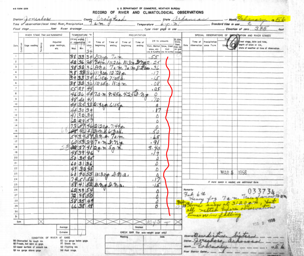
The above image is the log from February of 1956. This was not a good month for snow lovers. While a few flakes flew on February 10th, the comments show that it melted quickly. Temperatures moderated a lot this month. No teens. Not many 20s. And many days were in the 50s, 60s, and 70s! This is something worth noting! Also, we had severe weather, including tornados. Here are the tornadoes that occurred in February of 1956:


The above image is the climate log from December of 1995 from Terry Wood. The first thing that jumps out at me is the big swings in temperatures again! We had a couple of mornings in the TEENS, including 14° on the 16th. Yet, on Christmas Eve, it was 74°! That's wild!
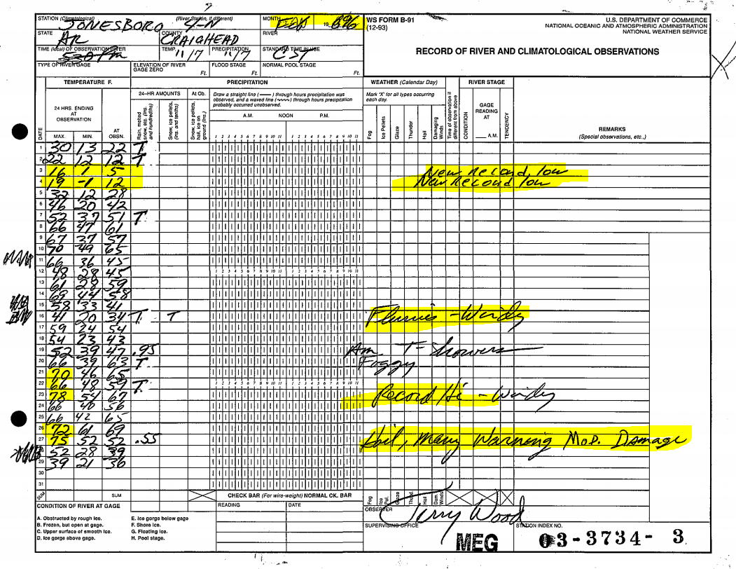
Let's look at January of 1996:

January of 1996 was WILD. At face value, there was only 2" of snow or less. BUT, let's dig deeper. Take a look at January 18th. The high was 64° and the low was 16°! The next morning is was 8°! In the comments, Terry notes that the wind chill was -30°!, but it's worth noting that the formula to calculate the wind chill changed in 2001. Still... IT WAS COLD!
Those big swings in temperatures also led to some severe weather. There were some tornadoes in January of 1996:

The Spring of 1996 that followed this winter was a busy one! Here are the tornadoes from March of 1996, which includes the long-track F3 tornado that went through Izard, Sharp, and Lawrence counties:


So, after looking over our current pattern and looking at what this pattern has done in the past, I've come up with 8 thoughts about the 2020-2021 Winter Season:
- The Winter starts early. Very cold air comes in for December
- Big swings in temperatures! Some mornings in the teens or single digits. Days later, much milder.
- We will challenge record lows and record highs.
- We will see 2-3 severe weather events with tornadoes possible.
- We will see 2-3 winter weather events.
- Wintry weather will likely include some sleet and freezing rain (glaze). Nothing like 2009 though.
- We will have some very windy days!
- We will see winter end early with a warm February, leading to an above average severe storm season in the Spring.
Ryan
2 comments:
Were we also transitioning from a weak El Nino pattern to a La Nina pattern in 1955-56 and 1995-96?
Wow! I guess be better get used to the roller coaster rides!
Post a Comment