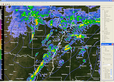
As I type this, I have already had 2"+ of rain at my house and it is still raining. While we have had some thunder and lightning, the risk for severe weather does not really exist right now. We're watching the unstable air south of us and it's still no guarantee that it will make it this far north. In the above image (click to enlarge), I have plotted the radar at 8:30 AM and the current dewpoints. I have hatched out the areas with dewpoints of 60 and above. That's the more moist and eventually the more unstable air. If our dewpoints do not climb to 60 or at least 55, our severe weather threat will be much, much lower. Now let's look at this evening...
The above image shows simulated radar and pressure. This has the low passing north of us, which could lead to more of an unstable environment. It shows some decent storm in SE Arkansas and I really feel confident that the greater threat will be along and south of I40. This can change and the forecast is very fluid today. There will be a lot of nowcasting today.Publish Post
Look for my Tweets on Twitter for updates between blog post at @ryanvaughan or on the right side of this page.
Ryan


No comments:
Post a Comment