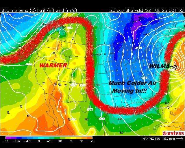
This map shows you what will be going on at the 850 millibar level on Tuesday morning (or at least what this computer model thinks will be going on!). That is at about 5,000 feet above your head. While this map can tell us a few things about what is going on in the atmosphere, we are going to focus on the color contours of the temperatures at this level. Looking at the temperatures at 5,000 feet above helps us determine our high temperatures for the day. Click image to enlarge.
This time of the year we see what the temperature is will be at 850mb (in Celsius) and add about 13 degrees to it. In the summer we add 15 degrees Celsius and in the Winter about 9-10 degrees. We then convert it to Fahrenheit. If you ever need a quick temperature convertion you can click here.
According to this computer model, we may not make it out of the 50s Tuesday!!! This may be a little optimistic for the fall-lovers. I think we will be around 60, which is MUCH better than the upper 80s we had earlier this week!
I added the red line to show the jetstream. Notice the big "U" in the East. That is a big trough that will stick around for awhile. 80s should be a thing of the past for a couple of weeks at least. Bring on Fall!
Ryan
rvaughan@wsfa.com
No comments:
Post a Comment