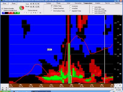
 If you click the above image, you can probably figure out when this model expects the line of storms to arrive (timeline, right to left). It appears a little earlier than previous data. In Jonesboro, the line of storms will likely be after 7:00 pm, but before 11:00 pm. Our western counties will see it a little earlier.
This is a massive cold front and some of the storms could be strong. For you weather geeks out there... CAPE is expected to be near 1800 and Lifted Index around -5. While Friday is suppose to be my day off, there is a chance you'll see me on the tube. I sure hope not!
Something else to note from the above image... The temperature is going to drop about 30 degrees within a couple of hours! Whoa!!!
Here's some good news for the farmers that still have some cotton out there... rainfall amounts should be low... possibly real low! More rain next week though...
Take care,
Ryan
rvaughan@kait8.com
No comments:
Post a Comment