I'm going to throw out some numbers, but don't hold them to me. This forecast is going to be teaked a few more times, especially since it is slowing down a lot and is not expected to start impacting us until late Thursday. I have a few points to pass along...
First, since this system is slowing down, cold air is going to have more time to come into the Midsouth. This should push our ice threat to areas along I-40. Little Rock to Wynne to Memphis need to be ready for that. The weather in Jonesboro should be all sleet and snow after some brief rain. The image above shows you the temperature and dewpoint as you go up through the atmosphere. Everything to the left of the blue line I drew is below freezing. If those green/red lines dip to the right of that... Then we have to look at a sleet/freezing rain setup. As I said, some will see both of those at times.... especially along I-40.
Second, the amount of accumulation is going to be tricky. If we get all snow... we get more. If sleet is mixed it, we get less. While sleet lowers the totals, it makes the roads worse. Most of the precip will fall Thursday night and Friday. Here are my thoughts on totals... Drum roll please...
I think Jonesboro will see .20" freezing rain, then 4-8" of sleet/snow.
Hardy, Salem, and Mtn. Home areas may see 6-9" of snow/sleet
Searcy, Augusta, Wynne, and Marion seeing the most ice with 0.50"-0.75" and 1" of sleet/snow.
As you can see, there will be a sharp drop off! This forecast will probably change and be tweaked, but that's what I'm thinking as of right now.
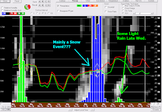
The above image is the morning run of the GFS model for Jonesboro. It shows mostly snow and the totals are quite wild. I won't even mention them, but they are more than my forecast at this time! I am still thinking we will have sleet mixed in and that will lower the totals... but still a substantial storm.
With that said, I do think there will be some "sweet" spots in the Region 8 viewing area that will have optimal snow potential and will see over 10". It's hard to pinpoint those spots right now.
I think the kid's will be in school on Thursday, but Friday is questionable.
Stay tuned!
Ryan


6 comments:
Hey ryan, if possible, would you include the bootheel region for the next time you say the totals of snow/sleet/frezzing rain. thank you, like kennett?
Ryan doesn't want me to say this, but one of those "sweet spots" is MY HOUSE, where 20" of snow will fall. :-)
I was shocked to wake up this morning and see the new data! The longer the precip stays away the more time there will be to get cold! Down here in Russellville looks to be pretty bad with Ice mainly and some snow! Hopefully Jonesboro see's that 4-8 inches! They deserve it after all these years most storms never make to Jonesboro! I think we could see some places in Southern Missouri with a foot of Snow by Friday afternoon! This looks to be the one!
Thanks for that ICE Ryan!!! lol I have the gas logs ready and my propane tanks were just filled!!! Thanks for the awesome job you do! RR
Thanks for the information Ryan. You do a great job.
Don't let it get bad ryan i have a baby doc appt that day and i don't want to miss it! lol i know you can't control it but if you do happen to have a magic weather remote in your back pocket plz push the not so bad we can't go no where in vehicle button.
Post a Comment