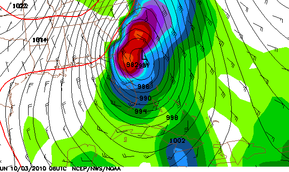
There's a lot of chatter about the Gulf of Mexico in the weather world today. Models continue to show the threat of a hurricane in the Gulf of Mexico in one week. The above image is from the 6Z GFS. I'm sure if you click the image to enlarge, you will clearly see the hurricane. This would be Matthew and it may be a FAST mover once it comes into the Gulf. See next image...
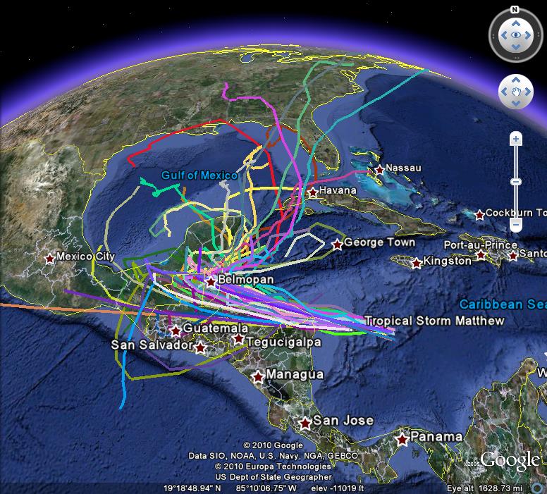
The GFS has this storm crossing over Florida, into the Atlantic over open water in 24 hours! Now, THIS IS JUST A MODEL and I'm pretty sure this will change a few times. There are SOO many things that will influence Matthew that a forecast this far out is extremely tough. In fact, look at the image below. Each line is a different solution for this storm. Get my point?
So, this will continue to be a system we need to watch. Some of you are asking why we track a system like Matthew in Region 8. First off, remember Ike? Ike brought 70 mph winds to Region 8! In addition, even a system on the East Coast will impact us here. The look the difference in pressure in the image below. The closer the lines are, the windier it will be here AND the winds will be drawn from the north inidicating some comfortable air. That would be nice...
Once again, this is SEVERAL days out. We'll keep you posted!
Have a great day! I'm off work to go see Seinfeld LIVE! WooHoo! J-Lo will have your forecast tonight.
Ryan


2 comments:
You mentioned yesterday that 11 records had been broken. Could you list them for us? Either here or on the webpage?
Thanks
Marty
Go here.. Check Record Event Report... Jonesboro... and then look at the dates in the drop down.
http://www.weather.gov/climate/index.php?wfo=meg
Hope that helps.
Post a Comment