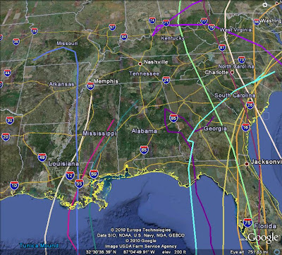
There is a disturbance in the Caribbean that the National Hurricane Center has given a "60% Chance" of forming into a named storm. Assuming it forms and it is the next one in line, it would be "Matthew". The above image shows the tracks of SEVERAL models (click to enlarge). As you can see, it's virtually a dart throw at this point. With that said, I see many signs that the residents in the Gulf of Mexico need to watch this! Here in Region 8, we should also watch this storm...
The above image is zoomed in over the Southeast. Notice how many models take it into LA, MS, and even AR. If that happened, we would see some rain from it.
This is still SEVERAL days out, but we'll watch it!
Ryan


No comments:
Post a Comment