The morning started to get interesting when the 12Z NAM data arrived.When forecasting, we often look at the 540 decameter line as the rough start to determine the rain/snow line. It's not always right on that line, so if you live by the 540 line, you'll also be burned by it. But, it is a good starting point.
The above map is for the lunch hour on Christmas Eve. That's as far out as the NAM model goes for now. Notice the blue line... that's the 540 line. Based on some other variables, I think the rain snow line will be a little farther south than that line.
Now let's look at the GFS model. It goes out farther and really gets me more excited. :) Here's the GFS on Christmas Eve. at the lunch hour:
It has the rain snow line farther south and a big slug of moisture moving through. And then it gets even better...
The rain/snow line dips farther south and we still have moisture, which would be snow if this played out... and also snow for Nashville if my family and friends over there are reading! Here's how it looks graphically on BUFKIT:
If it played out like the 12Z GFS indicated, a lot of people will be happy in Region 8! Keep in mind, this is a model and not exactly a forecast! At this time, I'm not sold on this enough to call for accumulations. I just want to get your hopes up a little! LOL
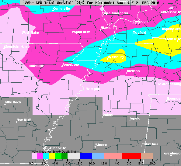
One more map to show you... This is a map created using an algorithm based on the 12Z GFS. Wouldn't this be nice:
Don't get excited yet... We'll keep watching it! Maybe working on Christmas Eve will not be that bad...
Ryan


No comments:
Post a Comment