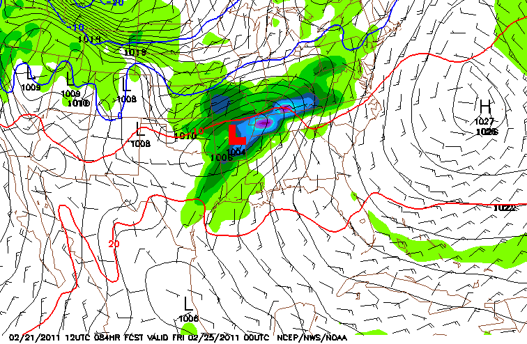
A decent center of low pressure is set to come through on Thursday (see image). Models are in pretty good agreement that we'll see a decent rainfall. There is some chatter about the threat of severe weather among the state too. As I have been mentioning on Twitter, I'm not sold on a severe weather outbreak. I'm not saying it is impossible and I'm not saying we will not see some severe watches, warnings, or even severe wx reports. I'm just saying that this does not appear to be an
outbreak with widespread damage. It's only Monday and I may feel differently tomorrow.
I DO think we will see lightning, hear thunder, and even see some heavy rain! Below is a map of the expected rainfall from the GFS:
Notice the area of red/orange on the map. That indicates 4-5 inches of rain! That would be enough to cause some issues in some spots.
So, stay tuned to the latest information. If I start feeling more confident about the severe weather threat, I'll tell yah!
Ryan

No comments:
Post a Comment