- Some showers and storms this evening. They should not be severe.
- Broken squall line moves across Region 8 between 10:00 PM and 3:00 AM
- Worst weather in Jonesboro will be around midnight.
- Straight-line winds are possible.
- Isolated tornado or two is possible.
- If a tornado develops, it may develop and dissipate quickly.
- Threat is gone by 3AM.
- Tornado "Watch" is likely
Let's show you some maps. First, showers and some storms this evening should not be severe. Here's what radar could look like around 6PM. At 6PM, the strongest storms will be in OK and TX:

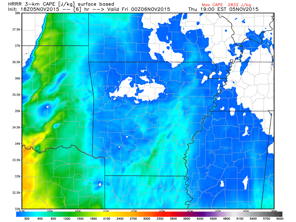
Here's the "Available Potential Energy" for storms at 6PM:
Here's the "spin" or helicity at 6PM:

Now let's look at midnight. Here's what radar could look like as the squall line moves through:

The air will still be rather unstable at midnight, if not more unstable:

The helicity "spin" will be much higher at midnight:

To summarize, the air becomes more volatile after many of us go to sleep. Make sure you have a way to get warnings that wake you up! Turn the weather radios on and text STORM to 52488 and then enter your county.
LIVE Facebook update at 2:00 PM.
Ryan
No comments:
Post a Comment