
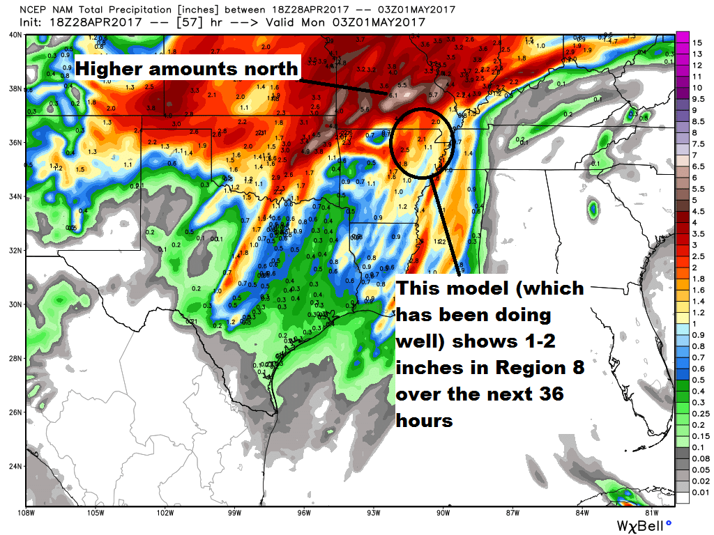
We knew this was a possibility because some data suggested that we would stay capped, with the heaviest rain being north of Region 8. That's exactly what happened:


Even if we do not have 5" of rain area-wide, we are still going to have river flooding because of all of the rainfall in Missouri. We will be watching river levels closely for you!
To summarize:
- The rain increases late today.
- Most areas will likely see 1-2" of rainfall.
- I think the flash flooding risk is low.
- Isolated areas will see 3-4" in stronger storms.
- Severe weather is possible with hail, damaging winds, and tornadoes.
- Rivers will flood.
No comments:
Post a Comment