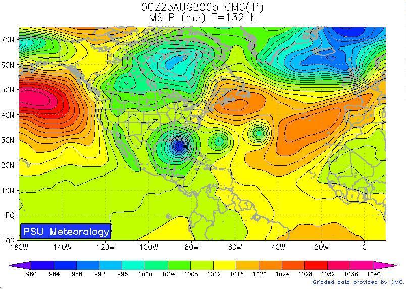
 This is the "Canadian" computer model. It's one of many computer models we use to forecast Alabama's wild weather. If you click the image to make it larger, you will see that this model is trying to forecast a big blue bullseye in the Gulf of Mexico. If that becomes reality, we could be dealing with some kind of named storm in 5-7 days. Will it become reality? My gut tells me "no", but when you have data popping up like what you see here... you have to stay on guard.
I didn't mention it too much this morning because it is still several days out. In the morning, I think people want to know what is going "right now" and what will happen in the next 24-48 hours. I still show the 7 day forecast, but I don't dwell on the extended forecast too much. I leave that up to Rich to do on the evening shows.
Another reason that I didn't talk too much about it is that I don't want to cause a panic... This feature is still several days out and people don't need to worry about it now. It is not even a "depression" yet! It could just be a few showers to dampen someone's beach trip! Stay tuned!
As always, feel free to email me at rvaughan@wsfa.com
No comments:
Post a Comment