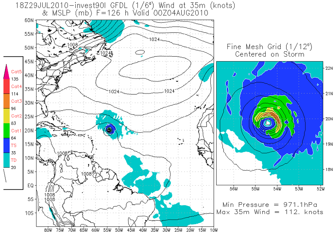
Some of the latest models are showing that we will have a hurricane in the Atlantic Basin within a few days. The above model is the GFDL and does a decent job as a whole. The legend on the right side indicates that we could have a Cat 2 hurricane early next week moving west.
The GFS model (above) also shows this feature. It's the green bullseye heading through the Caribbean. The big orange blob is a big ridge that should steer this tropical system westward into the Gulf. This needs to be watched closely to see if it affects our weather. If it did, it would still be SEVERAL days away (7-10).
Ryan

1 comment:
weather question
Why does it take so long for dew to dry off and when washed off grass dry so quickly?
Post a Comment